💡 Wisconsin Tornadoes: A Comprehensive Guide to Peak Seasons, Historical Patterns, and Safety Protocols
An in-depth look at Wisconsin's tornado patterns, peak seasons, historical events, and essential safety protocols for residents.
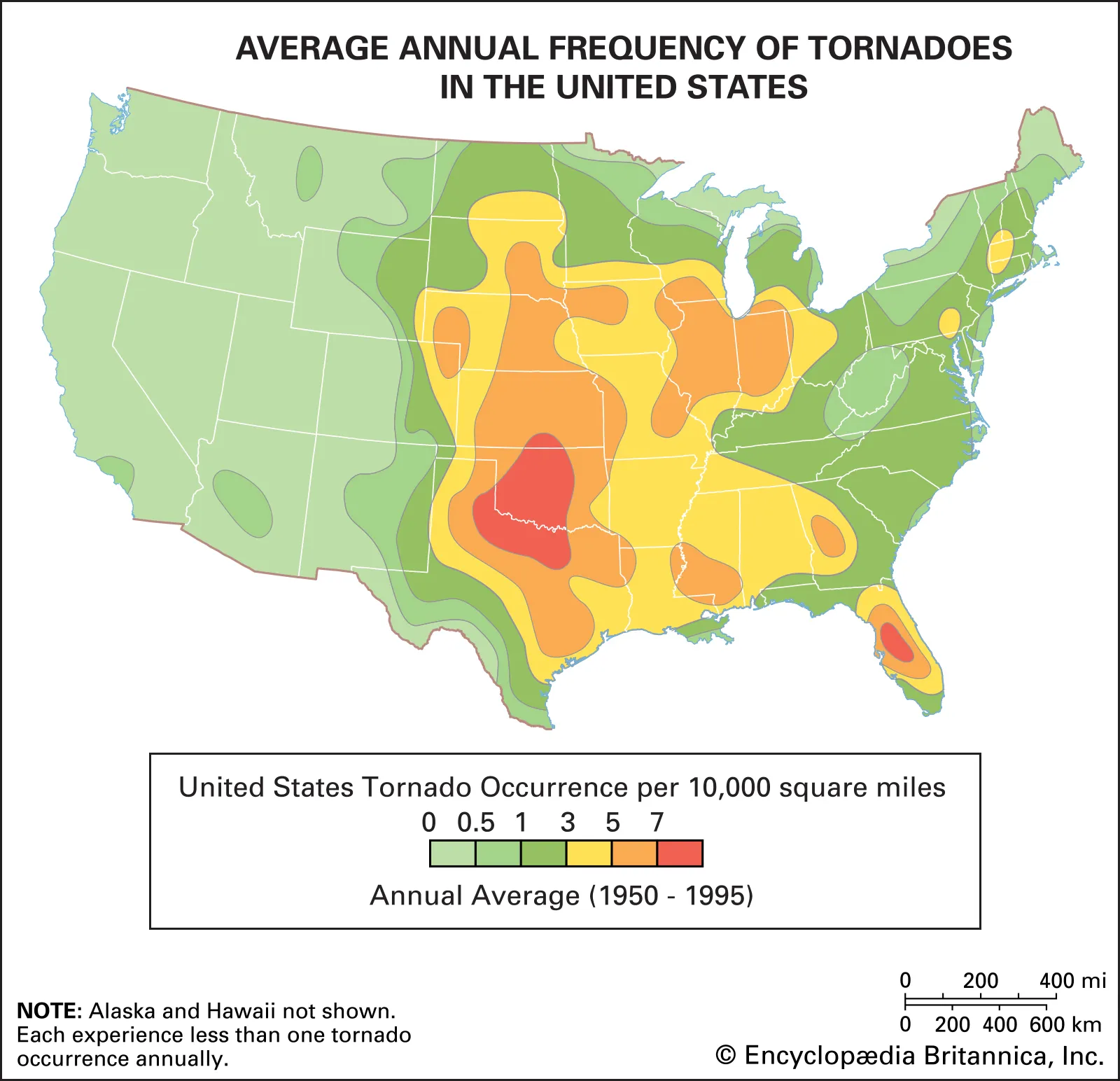
Wisconsin averages approximately 23 tornadoes per year, with the vast majority occurring during the peak season of May through August. While these storms can strike any part of the state at any time of year, they are most frequent in the southern and western counties where warm, moist air from the Gulf of Mexico regularly collides with cooler, dry air from Canada. Understanding these patterns and maintaining a proactive safety plan is the most effective way for Wisconsin residents to mitigate the risks associated with these powerful atmospheric events.
The Dynamics of Wisconsin’s Severe Weather Landscape
Wisconsin sits at a unique meteorological crossroads. To the north and west, the state is influenced by dry, continental air originating from Canada and the Rocky Mountains. To the south, the humid air of the Gulf of Mexico flows upward through the Mississippi River Valley. When these two drastically different air masses meet over the Badger State, the atmosphere becomes unstable.
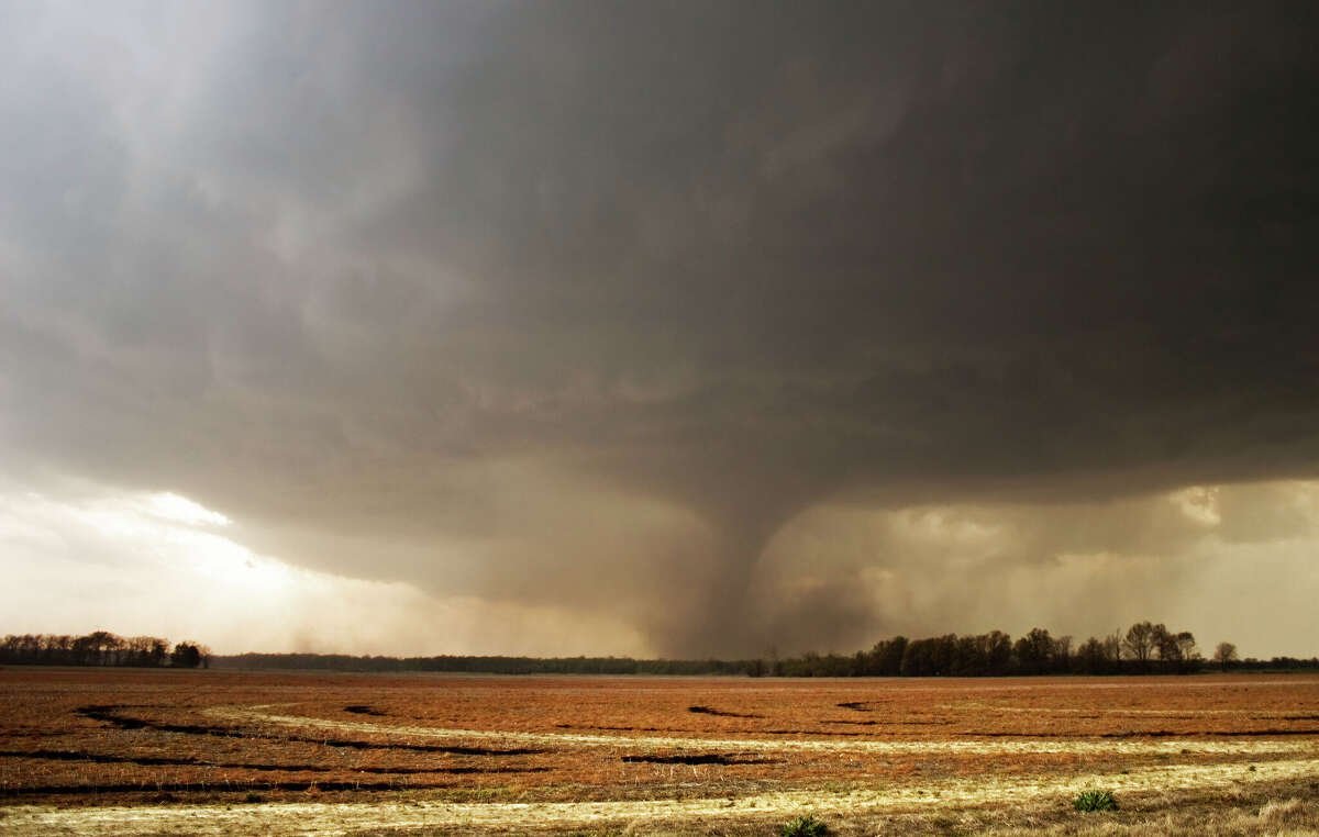
This instability is the fuel for supercell thunderstorms—the primary parents of tornadoes. Wisconsin’s landscape, ranging from the flat plains of the central sands to the rolling hills of the Driftless Area, also plays a role in how local winds behave. While hills and forests do not "stop" tornadoes, the varying terrain can influence low-level wind shear, which is the change in wind speed and direction with height that causes a storm to rotate.
Identifying Peak Tornado Season and Atmospheric Triggers in the Badger State
While Wisconsin has documented tornadoes in every month except February (historically), the primary window for severe activity is late spring and early summer. June is statistically the most active month for tornadoes in Wisconsin, followed closely by July and May. During this period, the jet stream—a ribbon of fast-moving air high in the atmosphere—often sits directly over the Midwest, providing the necessary "lift" to kickstart massive storm systems.
The primary atmospheric triggers include:
- Dew Points: When dew points climb above 60°F, the air has enough moisture to sustain long-lived storms.
- Cold Fronts: These act as a wedge, forcing warm air upward rapidly.
- Wind Shear: Strong winds aloft moving in a different direction than surface winds create the horizontal rolling motion that can be tilted vertically into a tornado.
Analyzing Wisconsin’s Most Significant Historical Tornado Events
Wisconsin’s history is marked by several powerful tornadoes that have reshaped communities. Examining these events helps us understand the potential scale of destruction. One of the deadliest occurred on June 12, 1899, in New Richmond. This F5 tornado killed 117 people and remains one of the darkest days in state history.
In more recent memory, the Barneveld F5 tornado of June 8, 1984, struck in the middle of the night, destroying much of the town and killing nine people. This event highlighted the extreme danger of nocturnal tornadoes, which are difficult to see and often strike when residents are asleep. Another landmark event was the Oakfield F5 in July 1996. While it caused massive property damage, improved warning systems and community preparedness resulted in zero fatalities—a testament to the importance of modern safety protocols.
Regional Risk Assessment: Why Southern and Western Wisconsin Face Higher Frequencies
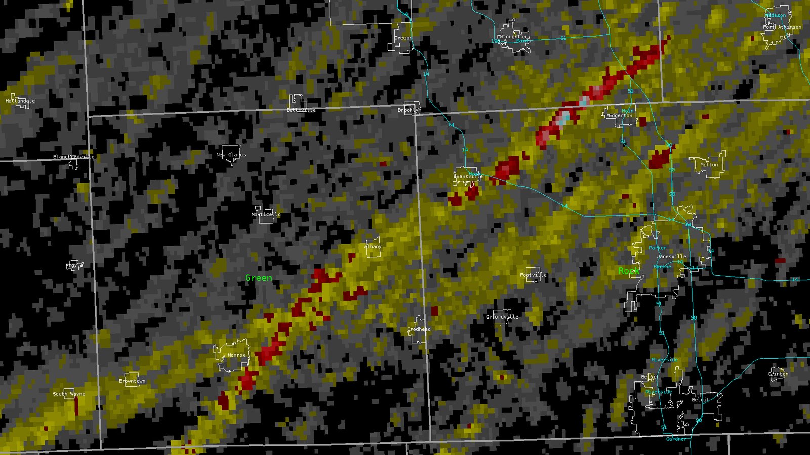
If you look at a heat map of Wisconsin tornado touchdowns, a clear pattern emerges. The highest frequency of storms occurs south of a line from La Crosse to Milwaukee. This is largely because the southern half of the state is more frequently exposed to the "warm sector" of passing low-pressure systems. These areas are the first to receive the influx of warm, unstable air moving north from the Great Plains and the Gulf.
Western Wisconsin, particularly the counties bordering the Mississippi River, also sees high activity. The river valley can act as a corridor for moisture, and the interaction between the valley's local winds and regional storm systems can enhance rotation in developing clouds. Conversely, Northern Wisconsin and the Lake Michigan shoreline often see fewer tornadoes due to the stabilizing effect of cooler lake waters and a generally cooler northern atmosphere.
Essential Preparedness Strategies for Wisconsin Residents and Homeowners
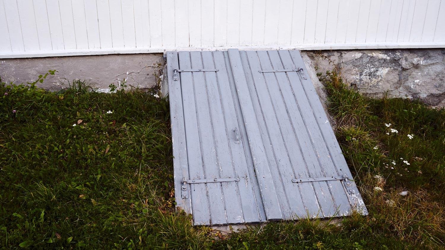
Preparation is the difference between a close call and a tragedy. For Wisconsin homeowners, the most important step is identifying a "safe place" before a storm ever develops. A basement is the gold standard for safety, but not all basements are created equal. You should move to the corner of the basement that is structurally soundest, typically away from windows and under a heavy workbench or the stairs.
Practical Tips for Your Storm Shelter:
- Keep Shoes Handy: Many injuries after a tornado are caused by walking through debris with bare feet. Keep a pair of sturdy shoes in your safe room.
- Head Protection: Helmets (bicycle, batting, or construction) significantly reduce the risk of head trauma from flying debris.
- Communication: Keep a battery-powered NOAA Weather Radio in your shelter to receive updates if the power or cell towers go down.
Understanding the Difference Between Tornado Watches and Warnings in Wisconsin
One of the most common mistakes is confusing a "Watch" with a "Warning." In Wisconsin, the National Weather Service offices in Sullivan, La Crosse, Green Bay, and Duluth issue these alerts based on specific criteria.
Tornado Watch: This means conditions are favorable for tornadoes to develop. It covers a large geographic area and usually lasts several hours. This is your signal to review your plan, check your emergency kit, and keep an eye on the sky. Think of it as having the ingredients to bake a cake.
Tornado Warning: This means a tornado has been sighted by a spotter or indicated by weather radar. There is an immediate danger to life and property. You should move to your safe place instantly. Think of this as the cake being out of the oven and on the table.
Frequently Asked Questions About Wisconsin Tornadoes
Can tornadoes cross the Great Lakes?
Yes, tornadoes can and do move from land to water (becoming waterspouts) and can occasionally move from water back to land. However, the cool air over Lake Michigan often acts as a shield, weakening storms as they approach the shoreline during the spring and early summer.
Do Wisconsin tornadoes only happen in the afternoon?
While peak activity occurs between 3:00 PM and 9:00 PM when atmospheric heating is at its maximum, tornadoes can occur at any time of day or night. Nocturnal tornadoes are particularly dangerous in Wisconsin due to the difficulty of visual confirmation.
Are sirens meant to be heard inside my house?
No. Outdoor warning sirens are designed specifically to alert people who are outdoors. They are not intended to wake you up or be heard over a television or loud air conditioner. Every Wisconsin household should have a secondary way to receive alerts, such as a weather radio or smartphone notifications.
Is it true that hills or rivers protect certain cities?
This is a myth. Tornadoes have crossed the Mississippi River and traveled over steep bluffs and ridges. No geographic feature in Wisconsin provides absolute protection from a tornado.
Conclusion
Wisconsin’s relationship with tornadoes is a permanent part of its climate reality. While the southern and western regions face the highest statistical risk, the entire state is susceptible to severe weather. By understanding that peak season falls between May and August, recognizing the critical difference between a watch and a warning, and maintaining a well-equipped basement shelter, residents can significantly increase their safety. Building a weather-ready Wisconsin starts with individual preparedness and a respect for the power of the Midwest atmosphere.


Comments 0
Leave a Reply
Your email address will not be published. Required fields are marked *
Be the first to share your thoughts!